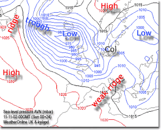
Isobar map features lines which join points of equal mean-sea-level-pressure. Isobar maps are extremely useful due to their ability to show elevations at a certain location. The map above is showing the elevation of UK and Ireland. By looking at the isobars above, you would easily be able to locate which locations are higher than others.
No comments:
Post a Comment